DOCUMENTS RELATING TO RAWES LANDS

SWINDALE
Swindale Head
A brief note from the Lowther Estate papers in Carlisle Record Office concerning Swindale Head Farm. Carlisle Record Office, D/Lons/L8/12.

"The farm was purchased by the Lowther Estate in 1894."


Notes:-
The whole area including the valleys of Mardale, Swindale, Wetsleddale were purchased from the Lowther Estate by the National Water Board in the 1930's. Preparations were made to flood Swindale but the outbreak of the 2nd World War put a stop to the plans, regrettably not before the Chapel and School at Truss Gap were demolished.

WASDALE
Wasdale Head
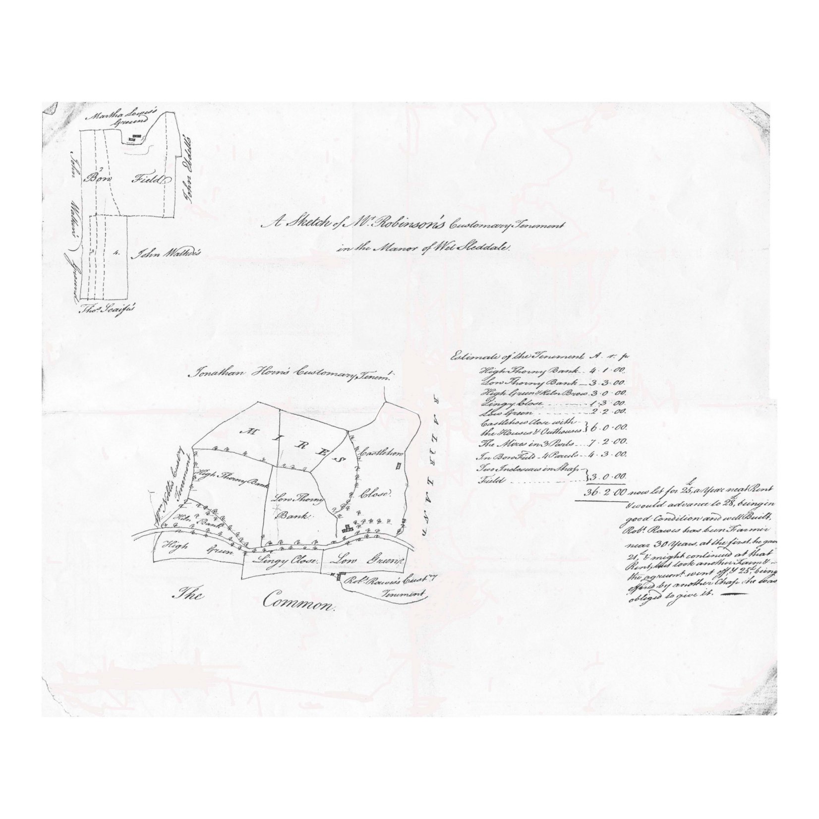
A description of Wasdale Head Farm, Shap in 1802. The following is a transcribed page taken from a booklet titled 'Lowther Hall Farms' dated 1802, located in the Lowther Estate Papers. Carlisle Record Office, D/Lons/L8/12.

Wasdale Head Wasdale Head
Wasdale Head

"This is also a mountain farm, but of much greater extent, / & higher situation than Wasdale foot. It may contain about / 2000 acres principally of high & barren mountains, & is most / suitable for a sheep farm. Wasdale Head is situated on the / north west side of the road from Shap to Kendal - There / is a tolerably good farm house, & other suitable conveniences / situated in a low vale near the middle of this farm, & / having about 80 acres of inclosed meadow \7 pasture / adjoining thereto - This inclosed land though coarse is / very useful for a tenent to keep a few cows, & a horse / upon - Farms of this description are very difficult / to estimate the value of, without having had some practise / in the kind of sheep farming, but from the best in for - / - mation which we could collect it may be worth about / £120 per annum. - These mountain farms should / be let by Proposal & not offered at any rent; because there are / many local circumstances which render them more or less valuable, but / which a stranger cannot be acquainted with from one temporary view."


Notes:-
The above records are to be found amongst the Lowther estate papers (Lons).

The Shap Registers indicate that Rawes's lived here in the early 18th century.

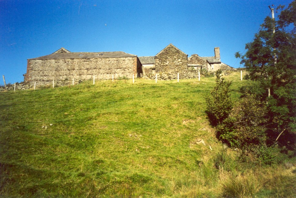
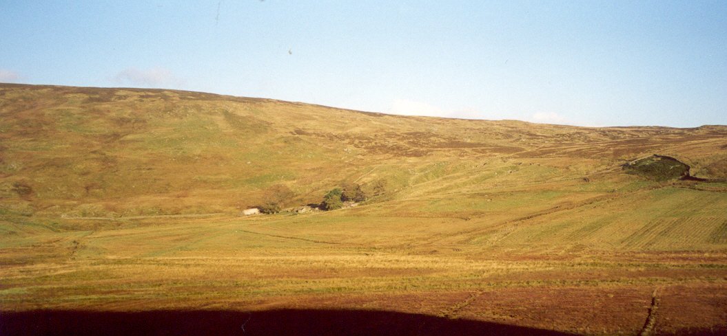
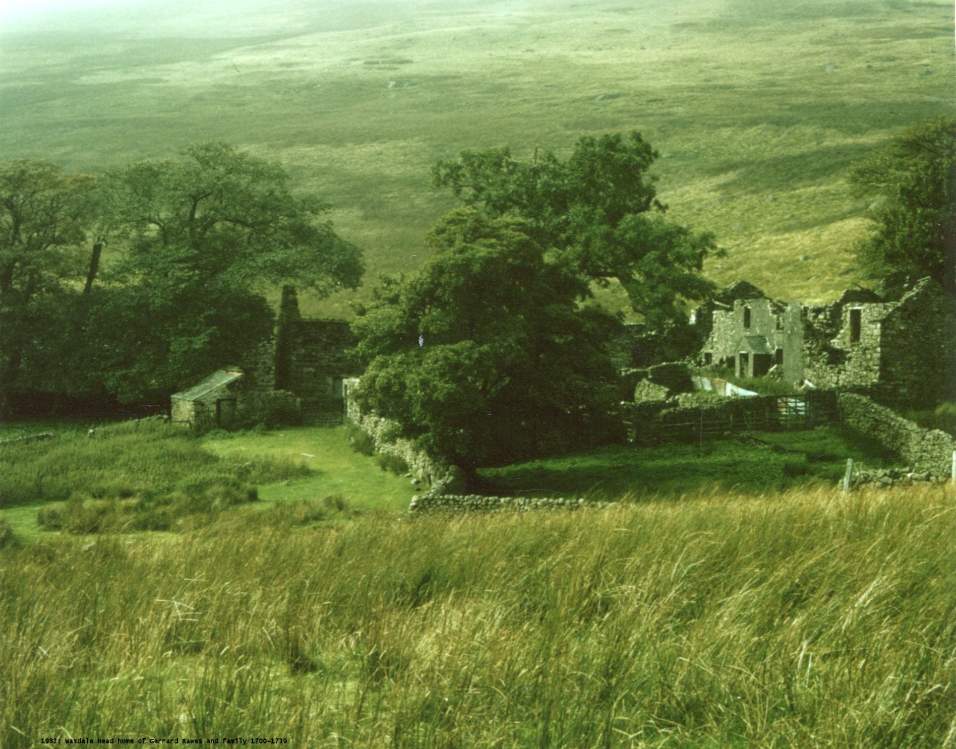
This remote property is now in a ruinous state with little prospect of restoration. It is believed that it was last inhabited during World War Two by someone employed at Forest Hall.

In 1771 Wasdale Head was purchased by the Lowther Estate from Mary only daughter of John Brown of Wasdale.

Transcribed from the original by Bryant Bayliffe of Brockworth, 2002

WETSLEDDALE
Sleddale Hall
A description of Sleddale Hall, Shap in 1802. The following is a transcribed page taken from a booklet titled 'Lowther Hall Farms' dated 1802, located in the Lowther Estate Papers. Carlisle Record Office, D/Lons/L8/12.

Sleddale Hall
Sleddale Hall

"Sledale Hall is situated a few miles south westwards from / Shap in a narrow valley among the mountains. We / could find nothing to give us any information as to the / quality of land in this farm. There is a considerable / extent enclosed on each side of the vale which is / at present singularly divided in to different fields. This we / calculated to be about 250 acres, consisting partly of woodland / partly of poorish meadow ground, and partly of pasture, all / of which, or nearly all, lies in rapid declivities. Besides / the above inclosed ground, there may be about 2300 / acres of barren mountains, forming altogether a tolerably / good sheep farm. The meadow ground is mostly capable / of improvement by draining, & that at a reasonable expense. / This farm, every thing considered we suppose may be worth / a rent of £150 But as observed before, our means of / calculating the value were very defective."


Notes:-
The above records are to be found amongst the Lowther estate papers (Lons).

Sleddale is now in a ruinous state. It is believed that Sleddale was the home of William Rawes, Yeoman of Sleddale sometime between 1740 and 1758.

Transcribed from the original by Bryant Bayliffe of Brockworth, 2002

Enclosure maps of Wetsleddale
The two Enclosure maps were found amongst the Lowther Estate papers held in the Carlisle Record Office. Unfortunately the Record Office reference number was not recorded. There is no date but they are assumed to be late eighteenth century. Carlisle Record Office, D/Lons/L----.


Estate Map one


Estate Map two
[Map 1:]
Roughly A3 in size. The map is aligned to the north and mostly depicts the area around Cowper Green and Thorney Bank with a small separate area around Bowfield. People mentioned on it are Rawes, Robinson, Lowis, Walker, Scaife, Eddell, Noble, Horn. Places mentioned are: Lingy, Green, Castlehow, Thorney, Bowfield, Mires.

[Map 2:]
Roughly A2 in size. The Ralphland is above the valley to the north while the Common lies to the south with the river Lowther flowing through the middle. People mentioned on it are Ivatson, Walker, Horn, Lowis, Rawes, Robinson. Places mentioned are: Thorney, Green, Castlehow, Lingy, Bowfield, Ralphland.


Notes:-
The above records are to be found amongst the Lowther estate papers (Lons).

Copied by Julian Rawes, 2002.