|
Selected Jury and rental documents from Box 10 of the Levens Hall Estate Papers.
The Area.
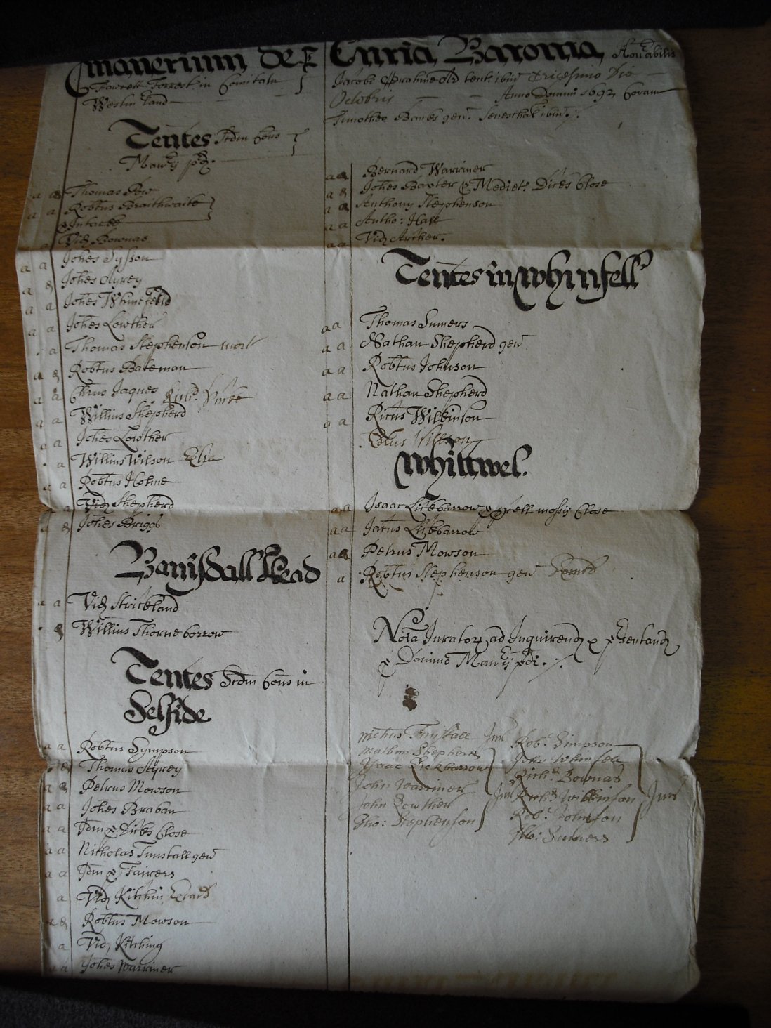
The area to which the documents relate is Fawcett Forest, a manor within the sub-parish of Selside. The Manor is situated on the slopes leading up to the Shap Fells and straddles the Great North Road (A6), and is administered from Forest Hall set alongside the A6 and covers both the scattered farmsteads across the Selside lowlands as well as Banisdale, Borrowdale and the Whatshaw Fell above Crookdale. The areas or divisions within the Rentals are:- Banisdale, Forest, Selside, Whatshaw, Whinfell, Whitwell.
There is no village of Selside in the normally accepted sense, as the Parish is made up of a scattering of farmsteads, a hall or manor house and a church set within rolling countryside sheltered by the dramatic fells to the north. Selside is a sub-parish of the great parish of Kendal. The documents refer to a number of farmsteads (messuages & tenements) dotted across the farmland and fells, more information on the farmsteads is detailed below.
The Documents.
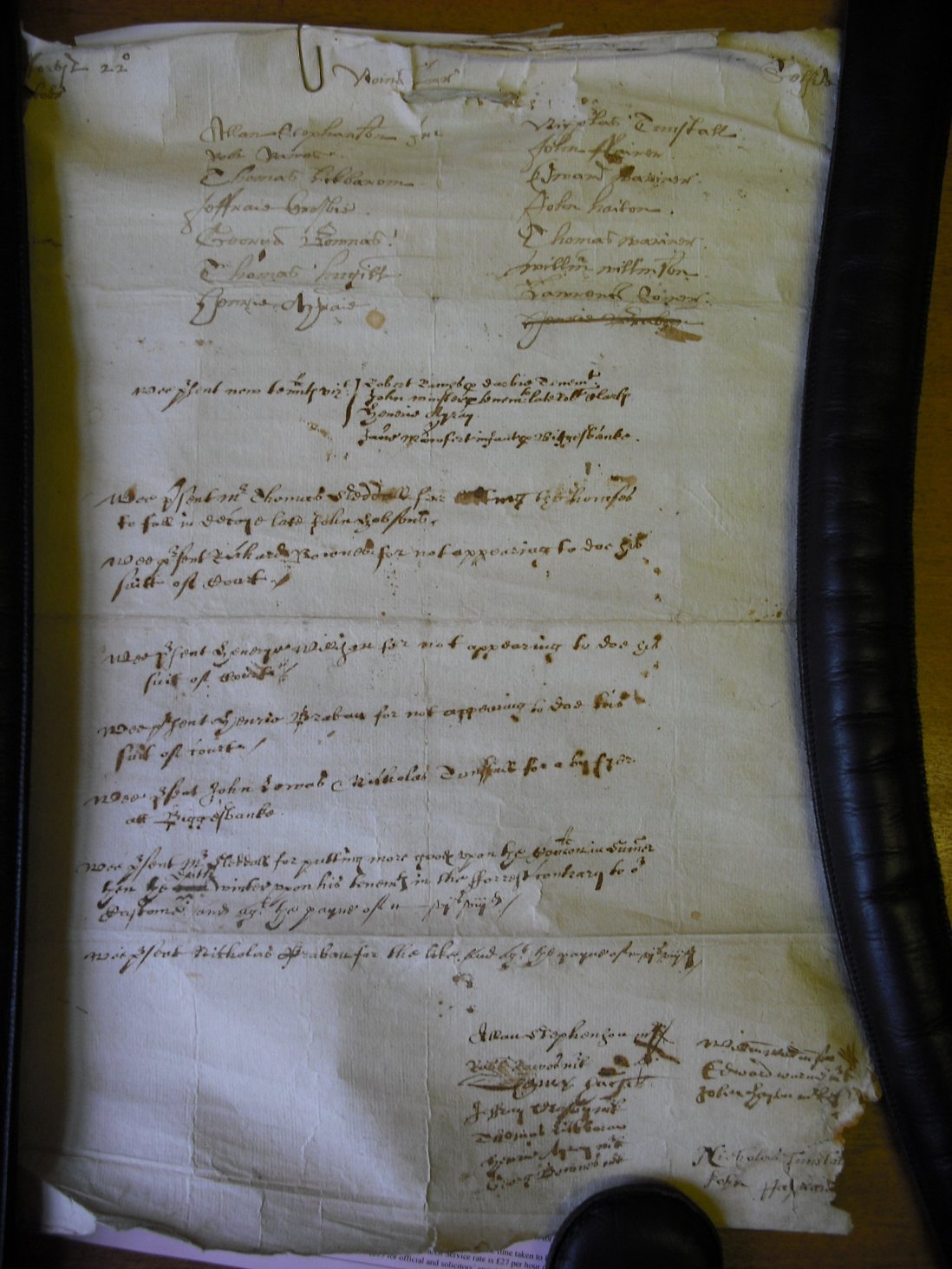
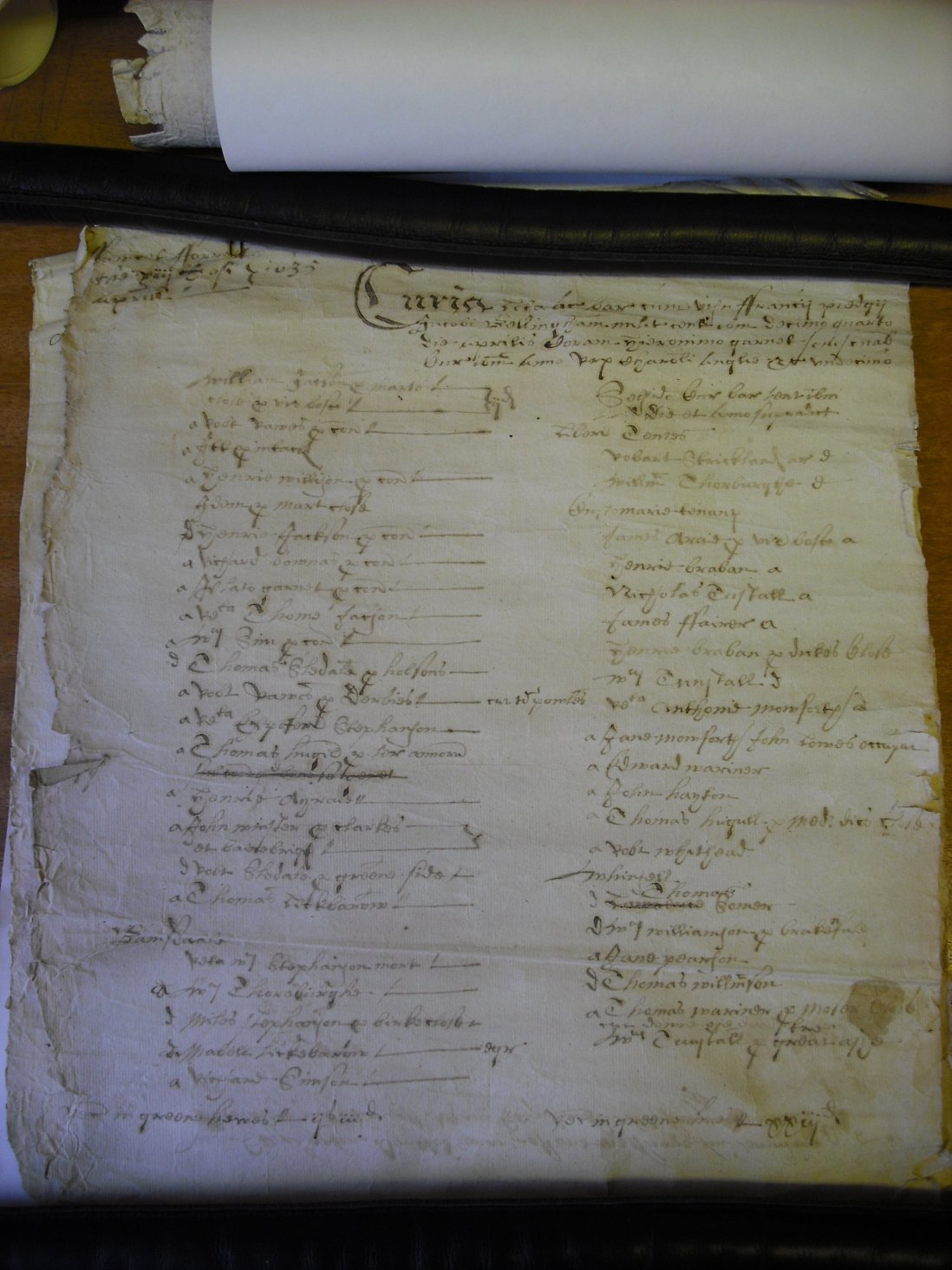
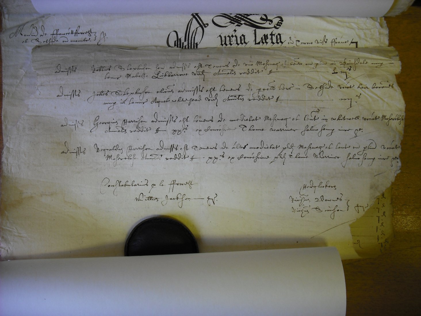
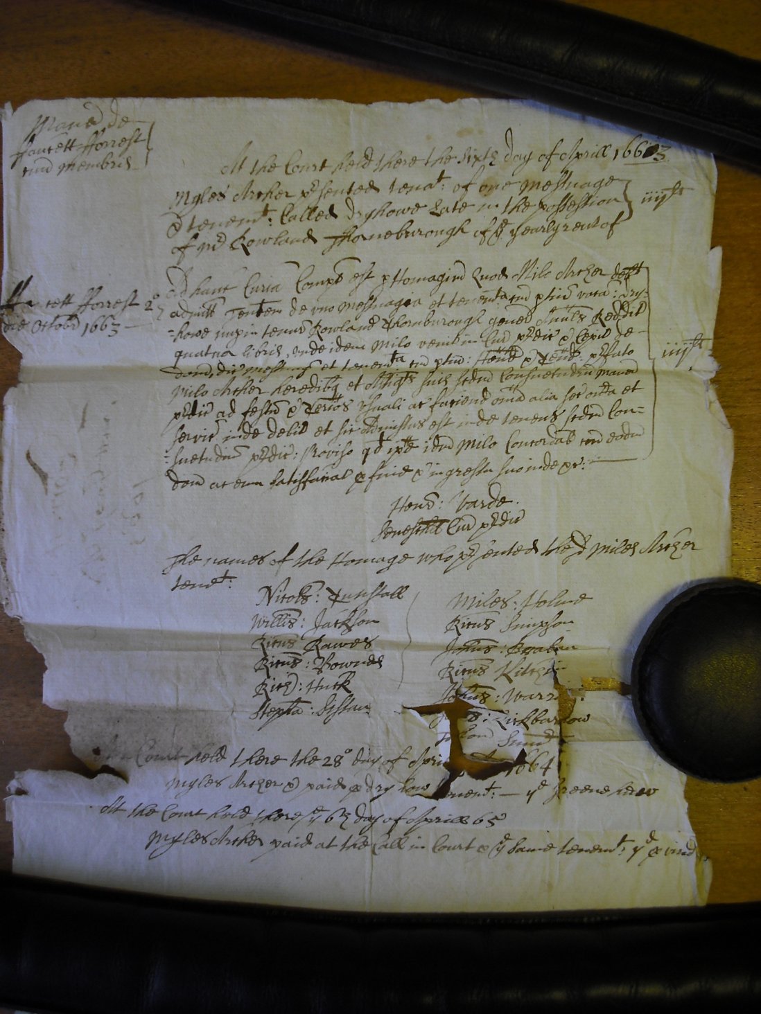
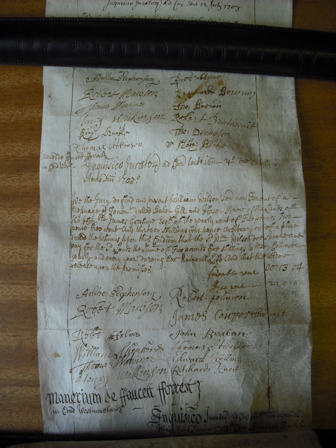
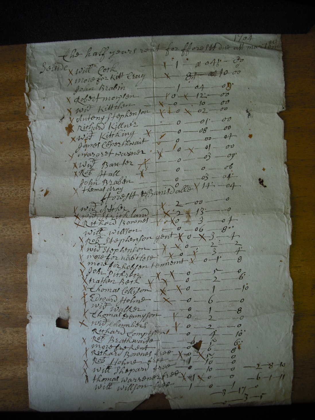
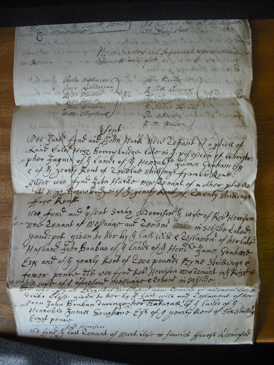
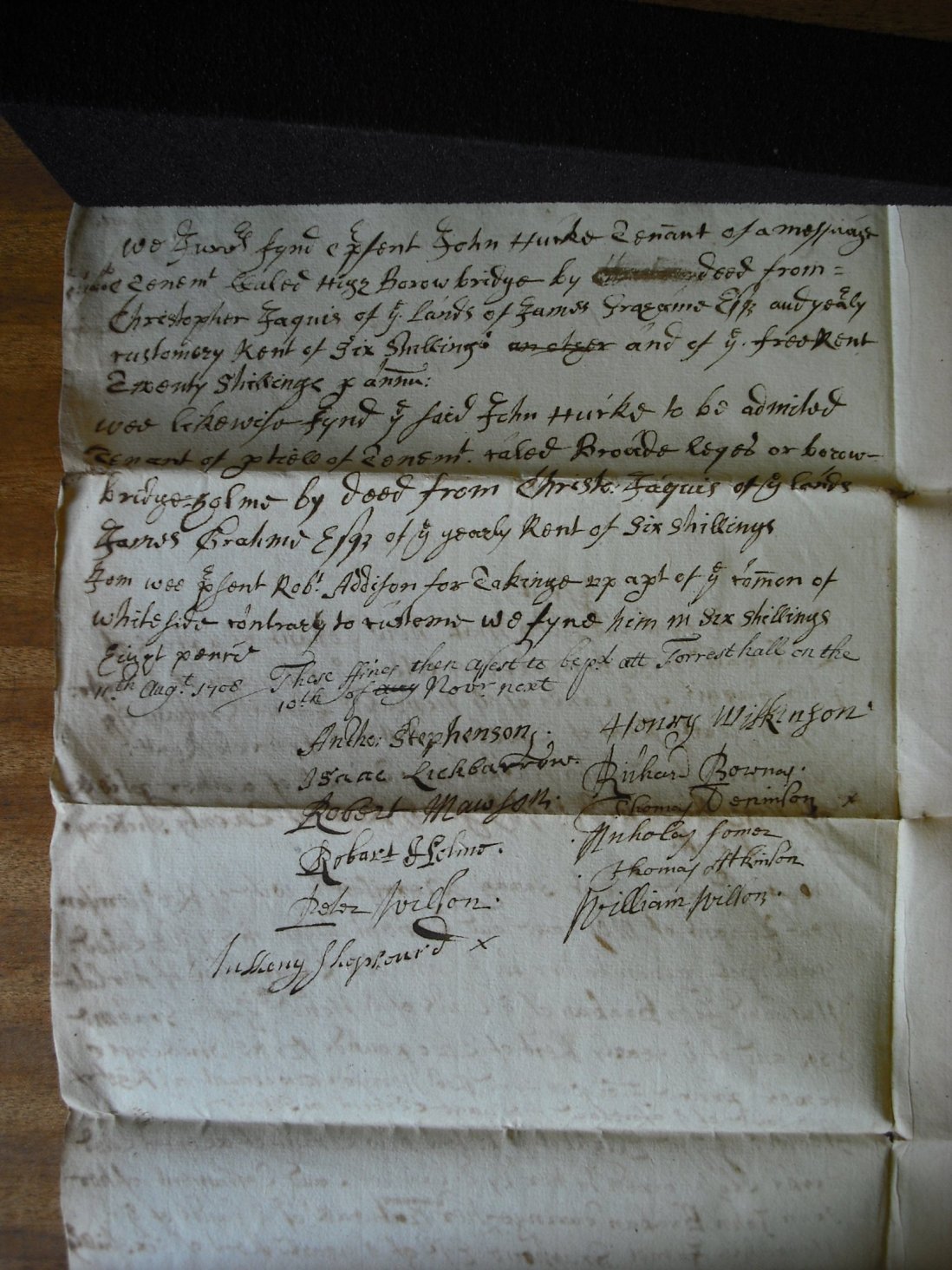
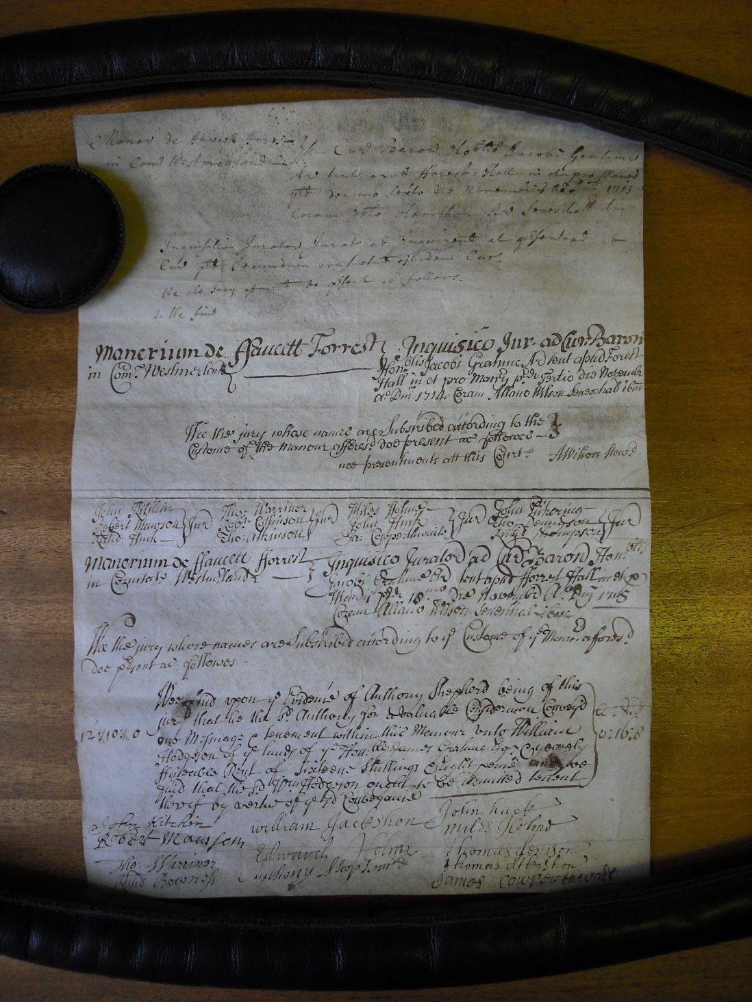
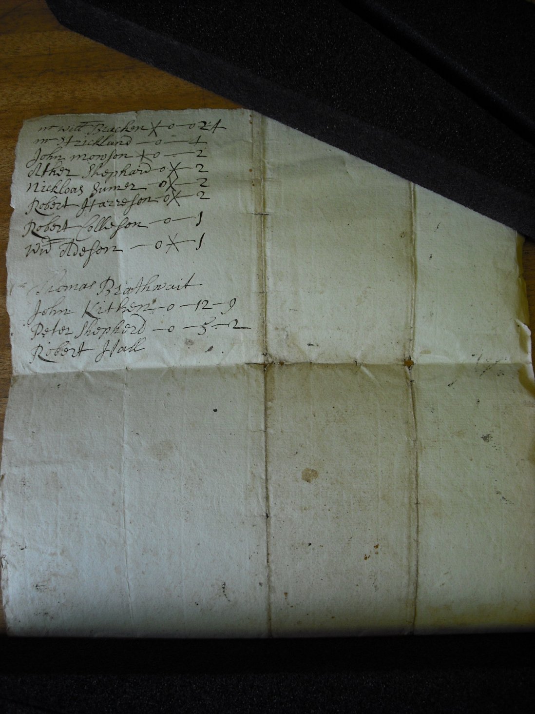
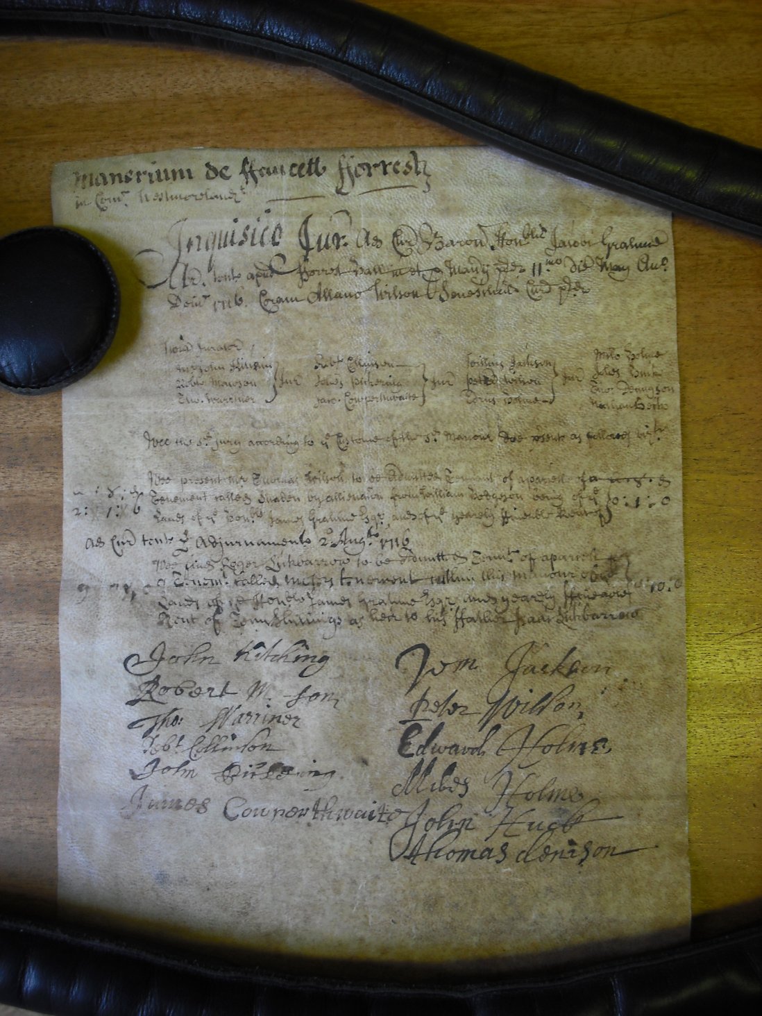
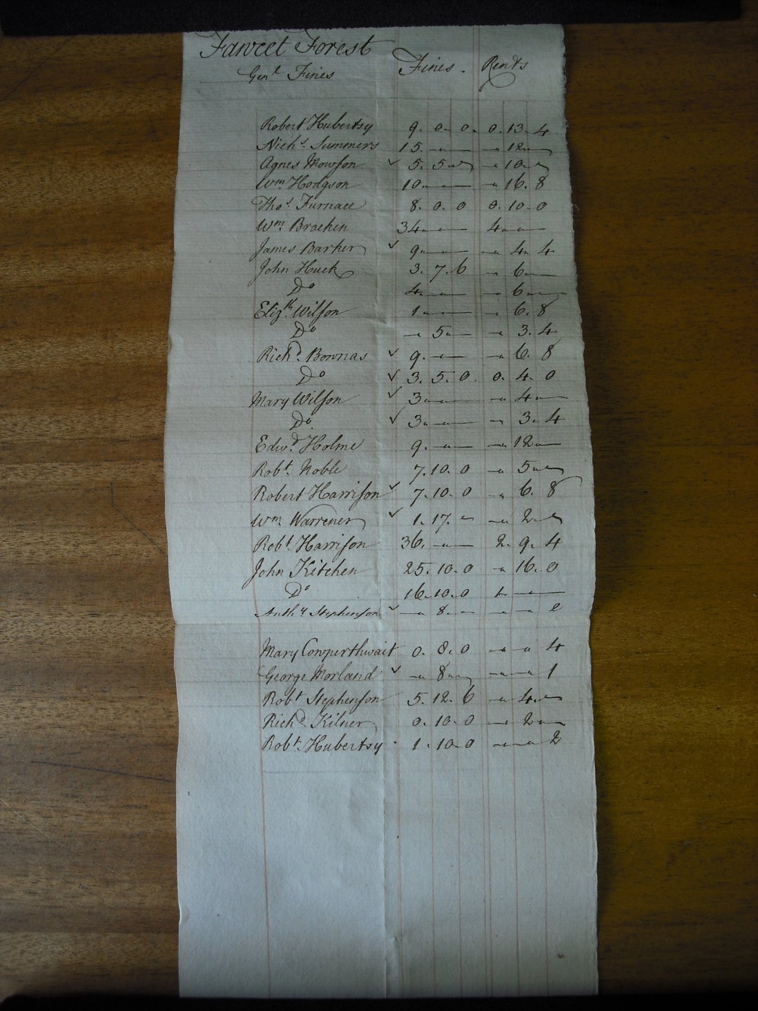
The documents from which this transcription is made are lodged in the archive room at Levens Hall Castle just south of Kendal. They are contained in Box 10 and relate to seventeenth and eighteenth century Jury verdicts and rental tythes of property and lands within the Fawcett Manor Estate. The owners of the Estate were the Graham family. The Fawcett Estate is now part of the Levens Hall Estate. The Levens Hall Estate archives is one of those rare examples of continuity where documents, from medieval times onwards, are still held by the family. The documents can only be viewed by special request via Kendal Record Office.
The items selected were photographed and then transcribed by Bryant Bayliffe and myself Julian Rawes. Many were very difficult to decipher, partly due to them being in Latin or faint or in some cases very poor handwrinting. Since we are not experts in this field some allowance must be made for omissions or errors.
The documents were written between 1626 and 1740. Some of the transcribed pages mention members of the Rawes, Huck and Kitchen families. There was a good degree of inter-marrying and the relationship between the families most have been complex. The Huck's lived at Borrow or Huck's Bridge where the Great North Road cuts through Borrowdale.
Rawes of Fawcett Forest.
As in previous attempts to find the Rawes family on the Shap Fells and in Selside (see 007.htm), great hope was placed on finding details of their residence within the Forest and also the origins of William Rawes of Selside (married by license in 1737). Parish Registers and marriage licences had already placed them in Fawcett Forest, Selside, Wastdale, Whinfell and in particular at High House in Borrowdale since at least the late 16th century.
Amongst the first documents obtained from the Levens Hall papers, there is mention of a Robert Rawes at High House. It is possible that this Robert Rawes is the son of Gerard Rawes of 'Fawcett Forest', an area that includes High House in Borrowdale. At first glance, after transcription, the documents did not give the 'great breakthrough' that had been hoped. They have however added to our knowledge of the Rawes. It is beginning to appear that there was no fixed dwelling house throughout the 17th century. It now seems apparent that Robert Rawes only obtained occupancy of High House in 1676, following the demise of Richard Kitchen in 1674, since in 1676 Robert Rawes appears to be making his first payment as tenant. Robert was buried in Kendal, 24 June 1703. Richard Rawes, Robert's presumed son, is recorded as 'of High House' in the Shap Registers when baptising his children in the early 18th century. The last mention of Richard at High House is on the baptism of his daughter Agnes in 1705. Richard (then styled of Orton) was buried at Selside church along with his son Robert on 17th February 1725. Lancelot Rawes of Barugh in Orton, is a presumed son of Richard Rawes.
Robert's assumed father, Gerard Rawes of Fawcett Forest, was baptised at Shap on 29th Oct 1598, the son of Robert Rawes of 'Fawcett Forest'. Amongst the documents some dating from circa 1620's. They list this Garard (Jarat) and also record another Robert Rawes (assumed father of Gerard). styled 'of Derbyes'. It is apparent that in the 1620's, this Robert Rawes took possession of a property occupied by William Derbye. As yet this property has not been identified on the ground. This Robert is believed to have married Elizabeth Darbie at Kendal 24th February 1595. Elizabeth was buried Kendal; 14th January 1625. Robert's father was another Gerard Rawes of Fawcett Forest, who was buried Kendal 12 June 1625. This Gerard is the first known 'Rawes' in the area. Also in these documents is listed a Richard Rawes. This Richard is believed to be the Richard Rawes of Whinfell recorded in the hearth Tax of 1669 as having three chimneys, a possible son of Robert Rawes of Derbyes.
The following pedigree is a very rough and tentative attempt at sorting out the relationships of the Rawes in Selside. There are however a number of other Rawes in Kendal and New Hutton.
                                       GERARD RAWES  =
                                  of Fawcett Forest  |
                             Bur Kendal 12 June 1625 |
                                                     |
                                                  ROBERT = Kendal 24 Feb 1595
                        Became an occupant of a property | Elizabeth Darbie
                        called Derbyes in the 1620's     | Bur 14 Jan 1625
                        from William Derbye. Styled of   |
                        Derbye 1632, 1643, 1659          |
                                    -----------------------------------------------------
                                    |                           |                       |
                                 GERARD =                    WILLIAM                 RICHARD
                   Bap Shap 29 Oct 1598 |                    of Bretherdale          In Hearth Tax 12 Jan 1669
                   of Fawcett Forest    |                    Tenant who failed       having 3 chimneys in Whinfell
                                        |                    to appear in Court      In Fawcett Rental 1663-70
                                        |                    1619                    =
                                        |                                            |
                       ---------------------------------             ----------------------------------
                       |              |                |             |               |                |
                    ROBERT          JAMES            JANE          ROBERT          GERARD           ELIZABETH
    Took over High House from       Bur Kendal       Bap 16 Aug    Bap Kendal      Bap Kendal       Bap Kendal
    Richard Kitchen 1676            13 Dec 1685      1629          15 May 1624     5 Nov 1627       5 Jan 1631
    also of Longsleddale                                                                            Bur 14 Dec 1694
    Bur Kendal 24 June 1703                                                                         of Whinfell
    = Ellin                        -------------------------------
    | Bur Longsleddale             |From at least 1699 High House|
    | 17 Jan 1693                  |was held in demesne.         |
   ------------------------------- -------------------------------
   |                             |
 GERRARD                        RICHARD
 (Jarrat)                       of High House
 of Wasdale Head                Styled of Orton
 Bur Shap 18 July               when Bur Selside
 1695                           17 Feb 1725 along
 = Crosby Ravensworth           with his son Robert
 | 1687 -------                 = ?Agnes
 |      Thompson                |
 |                              |
Fawcett Forest and its Surnames.
The documents show a relatively stable and close knit community with the occasional newcomer and the loss of a surname. The surnames are few and fairly unchanging. The Thornburgh's, Stevensons, Stricklands and Tunstalls seem to lead the pack as they mostly appear at the top of the lists and three members of the Thornburghs, Stricklands and Stevensons are armigerous. This may seem surprising for tenants living in such a remote and rugged terrain. It is of course possible that tenants may not necessarily imply living on the Estate but may simply be the holding of plots of land. The surnames that appear regularly are Ayrey, Bownas, Braban, Dennison, Hayton, Holmes, Huck, Hugill, Jackson, Kitchen, Lickbarrow, Minster, Mowfort, Rawes, Sleddale, Somer, Tunstall, Warrener, Wilkinson, Willeson, Wilson.
Similar documents appear in "Records Relating to the Barony of Kendal" compiled by William Farrer and published in several volumes in the 1920's.
Although this transcription only covers a small proportions of the material within Box 10, there is still however much information here relating to the other families, their comings and goings and complaints etc, It is a most valuable source for local history.
Properties and their families.
What is particularly valuable are connections between individuals and property. Following is a list of surnames associated with a particular property.
Ashstead: see Great Ash
Banisdale: a dale on or below the Shap Fells
Banisdale Head: Still inhabited at the head on Banisdale.
           Strickland, Thornburgh
Biggersbank: messuage & tenement, in Whitwell area of Selside
           Kitchin, Mowfort
Birk Close: tenement, not known - Birk Fells high up on the right of the A6
           Baxtor, Braban, Hebblethwaite, Hugill, Stevenson
Blaickthwaite: tenement, place not unknown
           Braithwaite, Hall, Kitchen, Shepherd
Borrow Bridge messuage & tenement, still inhabited, next to the A6 in Borrowdale
           Huck, Jacques
Borrowdale: a dale above Banisdale and Selside
Brackenfald: Maybe Brackenrigg in Whitwell area of Selside
           Withinson/Wittinson
Brickrigg: tenement, place not known
           Kilner
Brigghouse: place not known
           Bownes, Tunstall
Brigghouse, High: place not known
           Bownes, Jackson, Lickbarrow, Stevenson
Broad Reyet?: tenement, another name for Borrow Bridge
           Huck
Capshill House: see Coppehill
Clarkes: place not known
           Clark, Minster
Cooper House: (Cowper House), messuage & tenement, inhabited, near Plough Inn in Selside
           Kitchen
Coppehill House: tenement, place not known
           Huck
Crakensale: place not known. Ther is a Crake Hall in Selside
           Williamson
Deep Slack: still inhabited, below Whinfell
           Fairer, Tunstall
Derbies: tenement, place not known, home of Robert Rawes
           Derbye, Lancaster, Rawes
Dongarigge?: tenement, place not known
           Garnett
Dow Ouse: land, place not known
           Boatman, Hugill
Dryhowe: in Banisdale
           Archer, Thornburgh
Faw Close: land, place not known
           Bethouse
Forrest & Banisdale: an area administered by Fawcett Hall and in which Banisdale is part
Strickland, Tunstall, Walker, Warriner, Wilson,
Great Ash: believed to be the present Ashstead, near A6 below Martclose.
           Tunstall
Greenside: place not known
           Sleddall, Tunstall
Hare Borrow: messuage & tenement, still inhabited, below Whinfell
           Stevenson
Has Close: situated within Forrest & Banisdale
Hazell Bank: place not known, possibly an area
High Borrowbridge: see Borrow Bridge
High Borrowdale: messuage & tenement, now a ruin in Borrowdale
           Braithwaite, Jacques
High Brigg House:, (see Brigghouse), meeuage & tenement, place not known
           Lickbarrow, Stephenson
High Close: messuage & tenement, cauld be in Crookdale
           Warrener, Wilson
High House: used as a hunting lodge in Borrowdale
           Kitchen, Rawes (Rawes is only connected to High House in other documents)
Hill Cragg/Goat Pott: tenement, place not known
           Blackstock, Mawson, Tunstall
Hobsons: messuage & tenement, situated within Forrest & Banisdale
           Hobson, Lickbarrow, Sleddall, Stephenson
Hollowgate: tenement, still inhabited, close to the A6
           Edmondson, Huck
Hose Brow/House Brow: messuage & tenement, could be Hausefoot in Crookdale
           Warriner, Wilson
House Foot: messuage & tenement, probably Hausefoot in Crookdale, still inhabited
           Huck, Warriner, Wilson
Huterbank Court: Court in Long Sleddale
Inkes? Close: place not known
           Braban
Kitt Crag: in Selside near Yaud.
Mart Close: messuage & tenenment, still inhabited, situated below Hollowgate.
           Bownes, Harrison, Jackson, Parson, Willison
Inewt?: tenement, styled as "at Mart Close"
           Edmondson
Mosers?: tenement, still inhabited in Selside
           Lickbarrow, Warriner
Mosse Close: messuage & tenenment, probably in Whitwell, Selside
           Harrison, Lickbarrow, Warriner
Nab Close: tenement, place not known
           Lickbarrow, Stephenson
Scale Gill: messuage & tenement, could be in or above Crookdale
           Wilson
Selside: There is no village as such, Selside Parish covers a large area to the north east of Kendal.
           Baxter, Braban, Cowperthwaite, Hall, Hitching, Moroson, Stephenson, Warriner
Skale Green:  place not known, there is a Scale Fell high up above Borrowdale
           Willison
Snowden/Snaden: messuage & tenenment, in Selside near Greyrigg
           Hodgson, Johnson, Wilson
Stubbs Croft: tenement, place not known
           Shepherd, Stephens
Whatshaw: a fell above Crookdale, also an area
Whinfell: an area in Selside
           Johnson, Shepherd, Sumers, Wilkinson
Whitecross: place not known
           Harrison
Whitwell: an area of Selside
           Atkinson, Lickbarrow
Wolfhow Bank: messuage & tenement, somewhere above Forest Hall, west of the A6
           Dennison, Walker
Yaod (Yaud Pott): messuage & tenenment, in Selside
           Braban, Harrison
|